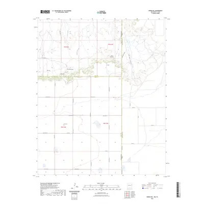
2023 Map of Endee Hill
USGS Topo · Published 2023About this map
Purcell and the surrounding high plains of the Llano Estacado define this modern survey of the New Mexico-Texas borderlands. The landscape is marked by the sharp transition from flat plateaus to deeply eroded drainage systems like Arroyo Trujillo and Arroyo del Puerto. High points such as Endee Hill, Round Mountain, and Rusk Hill provide essential landmarks for navigation across this sparsely populated region.
Find a feature on this map
37 named features on this map. Tap any name to fly to it.
Don’t see what you’re looking for? This feature index may not catch every label — zoom into the map to look around manually.
Map Details
Editions of this 2023 Endee Hill Map
This is the sole edition of this map. No revisions or reprints were ever made.
Other maps of this area

1954 · Tucumcari
USGS Topo · 1:250,000

1954 · Clovis
USGS Topo · 1:250,000

1958 · Clovis
USGS Topo · 1:250,000

1958 · Tucumcari
USGS Topo · 1:250,000

1966 · Sand Point
USGS Topo · 1:24,000

1968 · Rock Camp
USGS Topo · 1:24,000

1968 · Riley Camp
USGS Topo · 1:24,000

1971 · Mustang Lake
USGS Topo · 1:24,000

1971 · Garcia Lake
USGS Topo · 1:24,000

1971 · Day Canyon
USGS Topo · 1:24,000