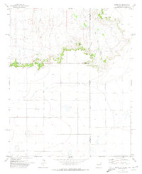
1971 Map of Endee Hill
USGS Topo · Published 1974About this map
Round Mountain and the prominent escarpment of Endee Hill dominate this high plains landscape at the New Mexico and Texas border. Surveyed in the early 1970s, the map reveals a sparsely settled ranching environment defined by deep drainage systems like Arroyo Trujillo and Arroyo del Puerto. The land use of the era is marked by numerous remote watering points, simply labeled Well or Wells, which sustained livestock across the arid terrain of Quay and Curry Counties.
Find a feature on this map
16 named features on this map. Tap any name to fly to it.
Don’t see what you’re looking for? This feature index may not catch every label — zoom into the map to look around manually.
Map Details
Editions of this 1971 Endee Hill Map
This is the sole edition of this map. No revisions or reprints were ever made.
Other maps of this area

1954 · Tucumcari
USGS Topo · 1:250,000

1954 · Clovis
USGS Topo · 1:250,000

1958 · Clovis
USGS Topo · 1:250,000

1958 · Tucumcari
USGS Topo · 1:250,000

1966 · Sand Point
USGS Topo · 1:24,000

1968 · Rock Camp
USGS Topo · 1:24,000

1968 · Riley Camp
USGS Topo · 1:24,000

1971 · Mustang Lake
USGS Topo · 1:24,000

1971 · Garcia Lake
USGS Topo · 1:24,000

1971 · Day Canyon
USGS Topo · 1:24,000