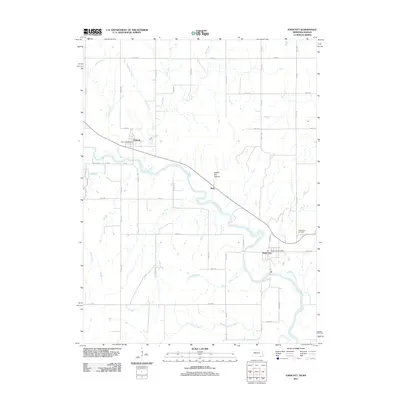
2011 Map of Endicott
USGS Topo · Published 2011About this map
The Little Blue River winds through this Jefferson County landscape, anchoring a rural network of small agricultural settlements and family-named roads. Centered on the community of Endicott, the area is defined by its numerous waterways including Turkey Creek, Rose Creek, and School Creek, which carve through the plains to create distinct terrain features like Steele City Canyon.
Find a feature on this map
46 named features on this map. Tap any name to fly to it.
Don’t see what you’re looking for? This feature index may not catch every label — zoom into the map to look around manually.
Map Details
Editions of this 2011 Endicott Map
This is the sole edition of this map. No revisions or reprints were ever made.
Other maps of this area

1889 · Marysville
USGS Topo · 1:125,000

1893 · Washington
USGS Topo · 1:125,000

1894 · Marysville
USGS Topo · 1:125,000

1955 · Manhattan
USGS Topo · 1:250,000

1955 · Lincoln
USGS Topo · 1:250,000

1956 · Manhattan
USGS Topo · 1:250,000

1957 · Manhattan
USGS Topo · 1:250,000

1957 · Lincoln
USGS Topo · 1:250,000

1958 · Lincoln
USGS Topo · 1:250,000

1960 · Fairbury SW
USGS Topo · 1:24,000