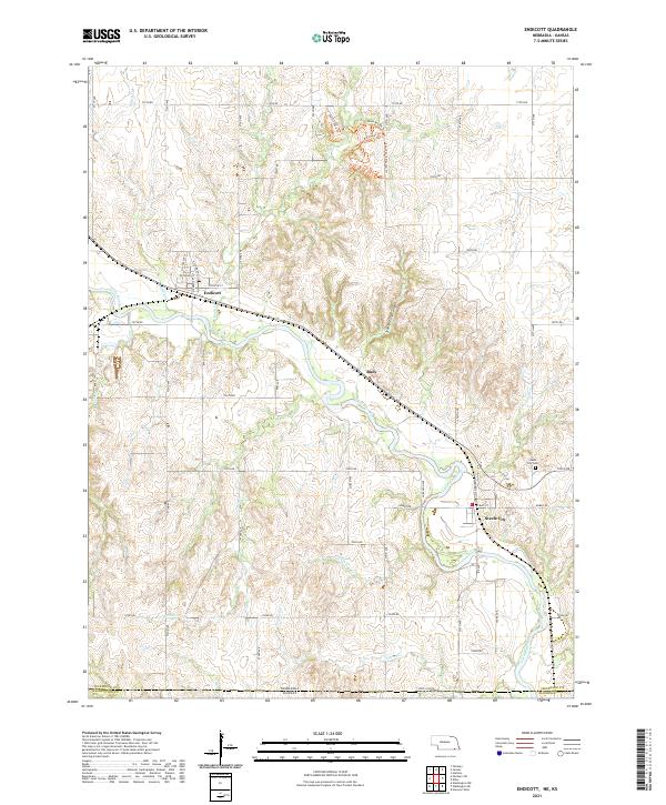
2021 Map of Endicott
USGS Topo · Published 2021About this map
Endicott and Steele City anchor this landscape along the Little Blue River in southern Jefferson County, just north of the Nebraska Kansas state line. The river valley is deeply etched by numerous tributaries including Rock Cr, Turkey Cr, and School Cr, creating a broken terrain characterized by features like Steele City Canyon. Historically significant transit is evident through the naming of the Burlington Trl and Main Branch Trl which weave through the northern hills near the Prairie Loop Trl. Genealogists and local historians can find the Steele City Cem situated near the town, while the small settlement of Rudy sits along the primary rail line and roadway corridor following the river's path. The map provides a detailed view of rural road networks, from 710th Rd in the north to Tango Rd near the State Line Rd.
Find a feature on this map
39 named features on this map. Tap any name to fly to it.
Don’t see what you’re looking for? This feature index may not catch every label — zoom into the map to look around manually.
Map Details
Editions of this 2021 Endicott Map
This is the sole edition of this map. No revisions or reprints were ever made.
Other maps of this area

1889 · Marysville
USGS Topo · 1:125,000

1893 · Washington
USGS Topo · 1:125,000

1894 · Marysville
USGS Topo · 1:125,000

1955 · Manhattan
USGS Topo · 1:250,000

1955 · Lincoln
USGS Topo · 1:250,000

1956 · Manhattan
USGS Topo · 1:250,000

1957 · Manhattan
USGS Topo · 1:250,000

1957 · Lincoln
USGS Topo · 1:250,000

1958 · Lincoln
USGS Topo · 1:250,000

1960 · Fairbury SW
USGS Topo · 1:24,000