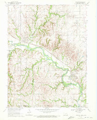
1970 Map of Endicott
USGS Topo · Published 1972About this map
Little Blue River valley industry and agriculture define this 1970 landscape, where the convergence of the Burlington Northern and Union Pacific railroads drove local development. The map details the village of Endicott and the town of Steele City, revealing the industrial footprint of the era through features like the Claypit, Kilns, and multiple Gravel Pits. These resource extraction sites, clustered near the river and rail lines, highlight the importance of the valley's geology to the local economy. Beyond the main settlements, the terrain is deeply dissected by numerous tributaries including Rock Creek, Spring Creek, and Turkey Creek. For genealogists, the Steele City Cem and the small settlement of Rose provide specific points of interest. The southern border of the map marks the Nebraska Kansas state line, cutting across the rural townships of Endicott and Newton.
Find a feature on this map
26 named features on this map. Tap any name to fly to it.
Don’t see what you’re looking for? This feature index may not catch every label — zoom into the map to look around manually.
Map Details
Editions of this 1970 Endicott Map
This is the sole edition of this map. No revisions or reprints were ever made.
Other maps of this area

1889 · Marysville
USGS Topo · 1:125,000

1893 · Washington
USGS Topo · 1:125,000

1894 · Marysville
USGS Topo · 1:125,000

1955 · Manhattan
USGS Topo · 1:250,000

1955 · Lincoln
USGS Topo · 1:250,000

1956 · Manhattan
USGS Topo · 1:250,000

1957 · Manhattan
USGS Topo · 1:250,000

1957 · Lincoln
USGS Topo · 1:250,000

1958 · Lincoln
USGS Topo · 1:250,000

1960 · Fairbury SW
USGS Topo · 1:24,000