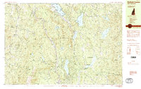
1984 Map of Enfield Center
USGS Topo · Published 1984About this map
Lower Shaker Village and Upper Shaker Village stand along the western shore of Mascoma Lake, anchoring a landscape defined by traditional New England settlements and a dense network of water bodies. This mid-1980s survey captures the area during a period of transition, where established rural communities like Enfield Center and Montcalm are situated among the high ridges of Shaker Mountain and Croydon Mountain. The mapping of several wildlife management areas, including the Enfield Wildlife Management Area, suggests a shift toward conservation and recreation.
Find a feature on this map
86 named features on this map. Tap any name to fly to it.
Don’t see what you’re looking for? This feature index may not catch every label — zoom into the map to look around manually.
Map Details
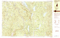
Editions of this 1984 Enfield Center Map
2 editions found
Other maps of this area

1902 · Sunapee
USGS Topo · 1:62,500

1905 · Sunapee
USGS Topo · 1:62,500

1906 · Hanover
USGS Topo · 1:62,500

1907 · Sunapee
USGS Topo · 1:62,500

1908 · Hanover
USGS Topo · 1:62,500

1926 · Claremont
USGS Topo · 1:62,500

1927 · Cardigan
USGS Topo · 1:62,500

1927 · Mascoma
USGS Topo · 1:62,500

1928 · Mount Kearsarge
USGS Topo · 1:62,500

1929 · Claremont
USGS Topo · 1:62,500