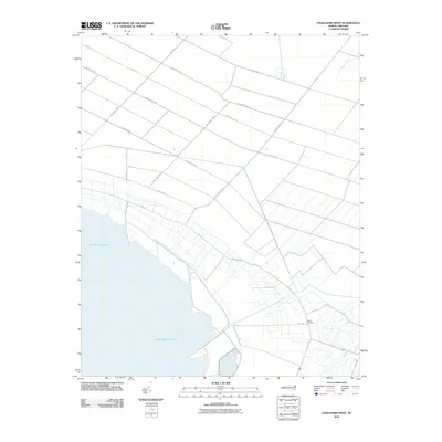
2010 Map of Engelhard West
USGS Topo · Published 2010About this map
Lake Mattamuskeet dominates the southern landscape of this coastal Hyde County quadrangle, where the natural shoreline meets a highly organized network of drainage and transport. The interior is defined by a distinctively rigid grid of thoroughfares, including 2nd Avenue West and 3rd Street West, reflecting the systematic agricultural development of the North Carolina lowlands. These corridors, along with the Jarvis Canal, illustrate the engineering required to manage this water-rich environment. Local history is anchored by the Fulford Cemetery in the southeastern quadrant, a site of genealogical importance near the intersection of several state routes. The transition from the structured avenues of the interior to the winding course of Swan Creek in the northeast highlights the intersection of human planning and the original hydrologic character of the coastal plain.
Find a feature on this map
23 named features on this map. Tap any name to fly to it.
Don’t see what you’re looking for? This feature index may not catch every label — zoom into the map to look around manually.
Map Details
Editions of this 2010 Engelhard West Map
This is the sole edition of this map. No revisions or reprints were ever made.
Other maps of this area

1943 · Columbia
USGS Topo · 1:125,000

1943 · Roanoke Island
USGS Topo · 1:125,000

1951 · Middletown Anchorage
USGS Topo · 1:24,000

1951 · Middletown
USGS Topo · 1:24,000

1951 · Engelhard West
USGS Topo · 1:24,000

1951 · New Holland
USGS Topo · 1:24,000

1951 · Engelhard East
USGS Topo · 1:24,000

1951 · Fairfield
USGS Topo · 1:24,000

1953 · Engelhard NW
USGS Topo · 1:24,000

1953 · Fairfield NE
USGS Topo · 1:24,000