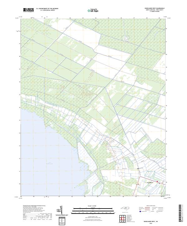
2022 Map of Engelhard West
USGS Topo · Published 2022About this map
Lake Mattamuskeet dominates the southwestern corner of this coastal Hyde County landscape, where the low-lying terrain is defined by a dense network of drainage canals and straight-line roads. The settlement of Engelhard serves as the local hub, situated near the intersection of several regional routes and the historic Fulford Cem. The transition from the open waters of the lake to the structured agricultural and wooded tracts is managed by features like Jarvis Canal and Swan Cr. This survey illustrates the intricate infrastructure required for habitation and farming in this wetland environment, characterized by numerous named tracks such as Logging Rd and Swamp Rd that provide access through the reclaimed coastal plains.
Find a feature on this map
23 named features on this map. Tap any name to fly to it.
Don’t see what you’re looking for? This feature index may not catch every label — zoom into the map to look around manually.
Map Details
Editions of this 2022 Engelhard West Map
This is the sole edition of this map. No revisions or reprints were ever made.
Other maps of this area

1943 · Columbia
USGS Topo · 1:125,000

1943 · Roanoke Island
USGS Topo · 1:125,000

1951 · Middletown Anchorage
USGS Topo · 1:24,000

1951 · Middletown
USGS Topo · 1:24,000

1951 · Engelhard West
USGS Topo · 1:24,000

1951 · New Holland
USGS Topo · 1:24,000

1951 · Engelhard East
USGS Topo · 1:24,000

1951 · Fairfield
USGS Topo · 1:24,000

1953 · Engelhard NW
USGS Topo · 1:24,000

1953 · Fairfield NE
USGS Topo · 1:24,000