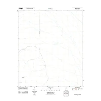
2011 Map of Engesser Pass SW
USGS Topo · Published 2011About this map
The Castle Dome Mountains dominate this southwestern Arizona desert landscape, characterized by numerous ephemeral washes cutting across the arid terrain. The map captures a high-desert environment where infrastructure is minimal, centered primarily on the corridor of Wellton Kofa Rd which serves as the primary artery through the region. Water sources are scarce in this remote corner of Yuma County, with Burnt Wagon Tank providing a rare, named point of interest for those navigating the arid expanses. The landform patterns and drainage systems documented here provide a detailed record of the desert's natural contours and the utilitarian road network that supported transit through the mountain foothills in the early twenty-first century.
Find a feature on this map
3 named features on this map. Tap any name to fly to it.
Don’t see what you’re looking for? This feature index may not catch every label — zoom into the map to look around manually.
Map Details
Editions of this 2011 Engesser Pass SW Map
This is the sole edition of this map. No revisions or reprints were ever made.
Other maps of this area

1928 · Norton
USGS Topo · 1:62,500

1929 · Norton
USGS Topo · 1:62,500

1942 · Yuma
USGS Topo · 1:250,000

1942 · Blythe
USGS Topo · 1:250,000

1942 · Vicksburg
USGS Topo · 1:250,000

1953 · Ajo
USGS Topo · 1:250,000

1954 · El Centro
USGS Topo · 1:250,000

1954 · Salton Sea
USGS Topo · 1:250,000

1954 · Phoenix
USGS Topo · 1:250,000

1955 · Salton Sea
USGS Topo · 1:250,000