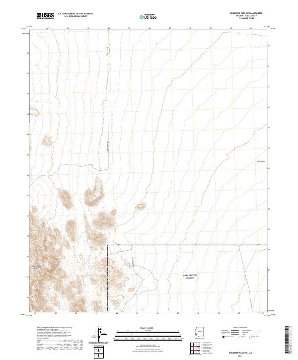
2021 Map of Engesser Pass SW
USGS Topo · Published 2021About this map
Castle Dome Mountains rise sharply in the southwestern corner of this desert landscape, providing a striking contrast to the broad expanse of King Valley that dominates the eastern half of the map. This arid environment is defined by its isolation and limited infrastructure, characterized primarily by the path of Wellton-Kofa Rd, which serves as the principal artery through this part of Yuma County. The map details a complex network of dry washes and desert terrain within the Public Land Survey System grids, including sections of t4s r17w and t5s r16w. The spatial relationship between the jagged mountain peaks and the vast valley floor illustrates the classic basin and range geography of the region, offering a clear view of the wilderness as it appeared during the 2019–2021 survey period.
Find a feature on this map
10 named features on this map. Tap any name to fly to it.
Don’t see what you’re looking for? This feature index may not catch every label — zoom into the map to look around manually.
Map Details
Editions of this 2021 Engesser Pass SW Map
This is the sole edition of this map. No revisions or reprints were ever made.
Other maps of this area

1928 · Norton
USGS Topo · 1:62,500

1929 · Norton
USGS Topo · 1:62,500

1942 · Yuma
USGS Topo · 1:250,000

1942 · Blythe
USGS Topo · 1:250,000

1942 · Vicksburg
USGS Topo · 1:250,000

1953 · Ajo
USGS Topo · 1:250,000

1954 · El Centro
USGS Topo · 1:250,000

1954 · Salton Sea
USGS Topo · 1:250,000

1954 · Phoenix
USGS Topo · 1:250,000

1955 · Salton Sea
USGS Topo · 1:250,000