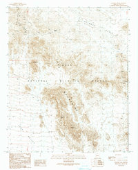
1990 Map of Engesser Pass
USGS Topo · Published 1990About this map
The Kofa Mountains dominate this 1990 survey, representing a landscape where mineral extraction and wildlife conservation intersect. The map documents the Engesser Mine, alongside various Adit and Mine Shafts markings, indicating a history of prospecting in the high desert. Much of the territory falls within the Kofa National Wildlife Refuge, where the preservation of native habitat is contrasted by the eastern border of the Yuma Proving Ground. Notable landmarks like Courthouse Mountain and Black Dome provide vertical relief above the broad Palomas Plain and King Valley. Vital water sources in this arid environment are scarce, with Frenchman Tank serving as a primary named catch basin for the region. This provisional edition was updated from aerial photography taken in 1985 and field-checked in 1987, capturing the remote infrastructure of Yuma County.
Find a feature on this map
22 named features on this map. Tap any name to fly to it.
Don’t see what you’re looking for? This feature index may not catch every label — zoom into the map to look around manually.
Map Details
Editions of this 1990 Engesser Pass Map
This is the sole edition of this map. No revisions or reprints were ever made.
Other maps of this area

1942 · Vicksburg
USGS Topo · 1:250,000

1954 · Phoenix
USGS Topo · 1:250,000

1957 · Phoenix
USGS Topo · 1:250,000

1958 · Phoenix
USGS Topo · 1:250,000

1960 · Phoenix
USGS Topo · 1:250,000

1962 · Little Horn Mts
USGS Topo · 1:62,500

1962 · Kofa Butte
USGS Topo · 1:62,500
1965 · Engesser Pass
USGS Topo · 1:62,500
1965 · Palomas Mts
USGS Topo · 1:62,500

1969 · Phoenix
USGS Topo · 1:250,000