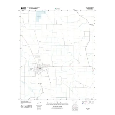
2011 Map of England
USGS Topo · Published 2011About this map
England serves as the primary hub in this low-lying Lonoke County landscape, where an intricate grid of agricultural roads and drainage channels dictates the rhythm of the land. The town is anchored by the England Post Office and supported by local aviation infrastructure, including the England Flying Service Airport and the nearby Capps Airport. This 2011 survey reveals a region shaped by its waterways, most notably the winding Wabbaseka Bayou, Bakers Bayou, and Indian Bayou, which thread between large cultivated fields. For those researching local history, the map identifies specific family and community sites such as Mulberry Cemetery and Nelon Cemetery, while the small settlement of Blakemore sits to the northeast. The geography here is defined by precision irrigation and the managed flow of water, visible in the straight-edged canals and the presence of Salt Lake in the eastern reach.
Find a feature on this map
38 named features on this map. Tap any name to fly to it.
Don’t see what you’re looking for? This feature index may not catch every label — zoom into the map to look around manually.
Map Details
Editions of this 2011 England Map
This is the sole edition of this map. No revisions or reprints were ever made.
Other maps of this area

1891 · Little Rock
USGS Topo · 1:125,000

1893 · Little Rock
USGS Topo · 1:125,000

1932 · Pastoria
USGS Topo · 1:62,500

1935 · Altheimer
USGS Topo · 1:62,500

1935 · Pastoria
USGS Topo · 1:62,500

1937 · England
USGS Topo · 1:48,000

1939 · Keo
USGS Topo · 1:31,680

1941 · Keo
USGS Topo · 1:31,680

1942 · Scott
USGS Topo · 1:31,680

1943 · England
USGS Topo · 1:62,500