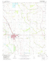
1982 Map of England
USGS Topo · Published 1982About this map
England serves as the central hub of this agricultural landscape in the early 1980s, where the St Louis Southwestern railroad cuts a diagonal line through the grid of Lonoke County. The town's layout is well-defined, featuring the England Academy and the local hospital, reflecting its role as a regional anchor. Surrounding the town, the land is heavily shaped by water and industry, with Clay Pits to the northwest and a network of drainage ways including Indian Bayou and Wabbaseka Bayou.
Find a feature on this map
28 named features on this map. Tap any name to fly to it.
Don’t see what you’re looking for? This feature index may not catch every label — zoom into the map to look around manually.
Map Details
Editions of this 1982 England Map
This is the sole edition of this map. No revisions or reprints were ever made.
Other maps of this area

1891 · Little Rock
USGS Topo · 1:125,000

1893 · Little Rock
USGS Topo · 1:125,000

1932 · Pastoria
USGS Topo · 1:62,500

1935 · Altheimer
USGS Topo · 1:62,500

1935 · Pastoria
USGS Topo · 1:62,500

1937 · England
USGS Topo · 1:48,000

1939 · Keo
USGS Topo · 1:31,680

1941 · Keo
USGS Topo · 1:31,680

1942 · Scott
USGS Topo · 1:31,680

1943 · England
USGS Topo · 1:62,500