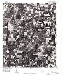
1975 Map of England NW
USGS Topo · Published 1977About this map
Pettus serves as a primary point of reference in this mid-1970s orthophotograph of Lonoke County, which provides a detailed visual record of the Arkansas delta’s agricultural landscape. The imagery reveals a complex patchwork of cultivated fields and drainage patterns defined by local watercourses. Meandering through the terrain are Bakers Bayou and Crooked Cr, their winding paths contrasting with the rigid geometry of the surrounding farms. The presence of Meto and a broad Bayou highlights the hydraulic characteristics of this region, where the natural hydrology has been adapted for large-scale farming. This orthophoto quadrangle is particularly useful for identifying 1970s property boundaries, drainage improvements, and the specific footprint of the settlement at Pettus before subsequent decades of land use changes occurred.
Find a feature on this map
5 named features on this map. Tap any name to fly to it.
Don’t see what you’re looking for? This feature index may not catch every label — zoom into the map to look around manually.
Map Details
Editions of this 1975 England NW Map
This is the sole edition of this map. No revisions or reprints were ever made.
Other maps of this area

1891 · Little Rock
USGS Topo · 1:125,000

1893 · Little Rock
USGS Topo · 1:125,000

1937 · England
USGS Topo · 1:48,000

1939 · Keo
USGS Topo · 1:31,680

1940 · Lonoke
USGS Topo · 1:62,500

1941 · Keo
USGS Topo · 1:31,680

1942 · Scott
USGS Topo · 1:31,680

1943 · England
USGS Topo · 1:62,500

1943 · Jacksonville
USGS Topo · 1:31,680

1948 · Helena
USGS Topo · 1:250,000