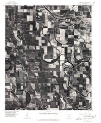
1975 Map of England SW
USGS Topo · Published 1977About this map
The agricultural landscape of Lonoke County is meticulously captured in this orthophotograph, showcasing the intricate drainage patterns and geometric land divisions surrounding the town of England. The visual data highlights the meandering course of Bakers Bayou as it snakes through productive Delta farmland, contrasting the organic curves of the water with the rigid rectangular grid of the surrounding fields. This 1975 imagery reveals the intensive land use of the era, where every acre is optimized for cultivation, leaving only narrow ribbons of vegetation along the bayou banks. Smaller outposts like Coy and the settlement of Jabb appear as compact clusters of structures, serving as local nodes within the wider rural network. This specific type of photographic survey provides a clear view of the road infrastructure and field boundaries that defined rural Arkansas life during the mid-1970s.
Find a feature on this map
4 named features on this map. Tap any name to fly to it.
Don’t see what you’re looking for? This feature index may not catch every label — zoom into the map to look around manually.
Map Details
Editions of this 1975 England SW Map
This is the sole edition of this map. No revisions or reprints were ever made.
Other maps of this area

1891 · Little Rock
USGS Topo · 1:125,000

1893 · Little Rock
USGS Topo · 1:125,000

1932 · Pastoria
USGS Topo · 1:62,500

1935 · Altheimer
USGS Topo · 1:62,500

1935 · Pastoria
USGS Topo · 1:62,500

1937 · England
USGS Topo · 1:48,000

1939 · Keo
USGS Topo · 1:31,680

1941 · Keo
USGS Topo · 1:31,680

1942 · Scott
USGS Topo · 1:31,680

1943 · England
USGS Topo · 1:62,500