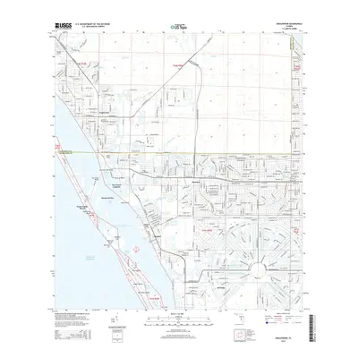
2015 Map of Englewood
USGS Topo · Published 2015About this map
Englewood and its neighboring coastal communities are defined by a complex network of barrier islands and tidal waterways along the Gulf of Mexico. This modern survey illustrates the established residential layout of the Rotonda development, with its characteristic circular street pattern and local drainages like the Rotonda River and Oakland Hills Creek. The shoreline is heavily shaped by the Intracoastal Waterway, which separates the mainland settlements of Sancassa and Grove City from the narrow reach of Manasota Key. Along this outer strip, Punta Gorda Beach and Englewood Beach provide access to Stump Pass and the open gulf. Significant local infrastructure is visible, including the Buchan Airport in the north and several waterway crossings such as the Tom Adams Bridge and Ainger Creek Bridge, reflecting the region's mid-20th-century growth into a retirement and recreational hub.
Find a feature on this map
65 named features on this map. Tap any name to fly to it.
Don’t see what you’re looking for? This feature index may not catch every label — zoom into the map to look around manually.
Map Details
Editions of this 2015 Englewood Map
This is the sole edition of this map. No revisions or reprints were ever made.
Other maps of this area

1944 · Myakka River
USGS Topo · 1:31,680

1944 · Venice
USGS Topo · 1:31,680

1956 · Murdock
USGS Topo · 1:24,000

1956 · Englewood
USGS Topo · 1:24,000

1956 · Tampa
USGS Topo · 1:250,000

1956 · Charlotte Harbor
USGS Topo · 1:250,000

1957 · Englewood NW
USGS Topo · 1:24,000

1957 · El Jobean
USGS Topo · 1:24,000

1957 · Punta Gorda SW
USGS Topo · 1:24,000

1957 · Placida
USGS Topo · 1:24,000