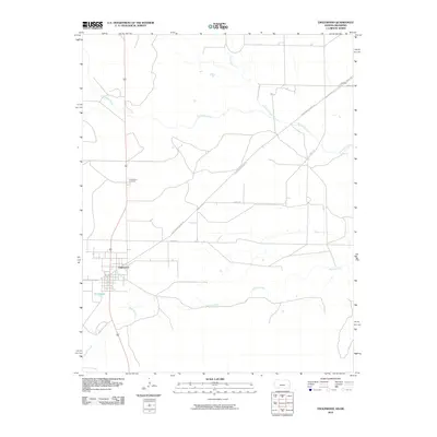
2010 Map of Englewood
USGS Topo · Published 2010About this map
Englewood serves as the primary hub of this high plains landscape, situated near the southern border of Clark County where the terrain is defined by a dense network of intermittent drainage. The town layout is clearly defined against the surrounding ranch land, with the Englewood Cemetery located to the north along the main thoroughfare. Water management and natural flow are central to the area's geography, evidenced by the presence of Perry Lake and the confluence of several seasonal streams including Fivemile Creek and Bullard Creek. The map documents a contemporary transition in land use and travel, featuring traditional named routes like Angle Rd alongside the more evocative Shortgrass Prairie Trl, which suggests the preservation of the region's native ecological character. Larger waterways like Big Sandy Creek and Antelope Creek meander across the northern sections, illustrating the hydrologic patterns that have long governed settlement in this part of Kansas.
Find a feature on this map
10 named features on this map. Tap any name to fly to it.
Don’t see what you’re looking for? This feature index may not catch every label — zoom into the map to look around manually.
Map Details
Editions of this 2010 Englewood Map
This is the sole edition of this map. No revisions or reprints were ever made.
Other maps of this area

1892 · Meade
USGS Topo · 1:125,000

1896 · Ashland
USGS Topo · 1:125,000

1954 · Perryton
USGS Topo · 1:250,000

1955 · Woodward
USGS Topo · 1:250,000

1955 · Pratt
USGS Topo · 1:250,000

1955 · Dodge City
USGS Topo · 1:250,000

1958 · Perryton
USGS Topo · 1:250,000

1958 · Woodward
USGS Topo · 1:250,000

1958 · Dodge City
USGS Topo · 1:250,000

1959 · Pratt
USGS Topo · 1:250,000