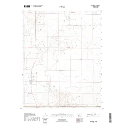
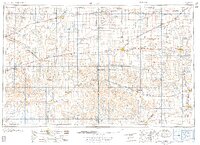
2018 Map of Englewood
USGS Topo · Published 2018About this map
Englewood sits at the southwestern edge of Clark County, Kansas, serving as a hub for the surrounding ranchlands just north of the Kansas-Oklahoma state line. The town's grid is clearly defined by local streets such as Reiman St and Douglas Ave, while the northern outskirts are home to the Englewood Cem. This 2018 survey reveals a landscape shaped by intermittent watercourses like Big Sandy Cr and Antelope Cr, which drain the undulating High Plains terrain. To the south, Bullard Cr and Fivemile Cr weave toward the state border, highlighting the geographic isolation and specialized transport routes like Angle Rd and CR BB that connect these remote settlements to the wider region. Near the town center, Perry Lake provides a localized water feature in this largely arid environment.
Find a feature on this map
44 named features on this map. Tap any name to fly to it.
Don’t see what you’re looking for? This feature index may not catch every label — zoom into the map to look around manually.
Map Details
Editions of this 2018 Englewood Map
This is the sole edition of this map. No revisions or reprints were ever made.
Other maps of this area
1892 · Meade
USGS Topo · 1:125,000
1896 · Ashland
USGS Topo · 1:125,000
1954 · Perryton
USGS Topo · 1:250,000
1955 · Woodward
USGS Topo · 1:250,000
1955 · Pratt
USGS Topo · 1:250,000

1955 · Dodge City
USGS Topo · 1:250,000
1958 · Perryton
USGS Topo · 1:250,000
1958 · Woodward
USGS Topo · 1:250,000

1958 · Dodge City
USGS Topo · 1:250,000
1959 · Pratt
USGS Topo · 1:250,000