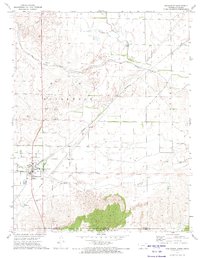
1972 Map of Englewood
USGS Topo · Published 1974About this map
Englewood serves as the focal point of this 1970s landscape, situated just north of the Kansas Oklahoma state line. The town's grid is clearly defined, featuring a Water Tank and proximity to the Englewood Cem. A significant historical landmark, the Old Indian Treaty Boundary, bisects the southern portion of the sheet, providing a distinct geographic marker of earlier tribal land agreements and surveying history.
Find a feature on this map
21 named features on this map. Tap any name to fly to it.
Don’t see what you’re looking for? This feature index may not catch every label — zoom into the map to look around manually.
Map Details
Editions of this 1972 Englewood Map
This is the sole edition of this map. No revisions or reprints were ever made.
Other maps of this area

1892 · Meade
USGS Topo · 1:125,000

1896 · Ashland
USGS Topo · 1:125,000

1954 · Perryton
USGS Topo · 1:250,000

1955 · Woodward
USGS Topo · 1:250,000

1955 · Pratt
USGS Topo · 1:250,000

1955 · Dodge City
USGS Topo · 1:250,000

1958 · Perryton
USGS Topo · 1:250,000

1958 · Woodward
USGS Topo · 1:250,000

1958 · Dodge City
USGS Topo · 1:250,000

1959 · Pratt
USGS Topo · 1:250,000