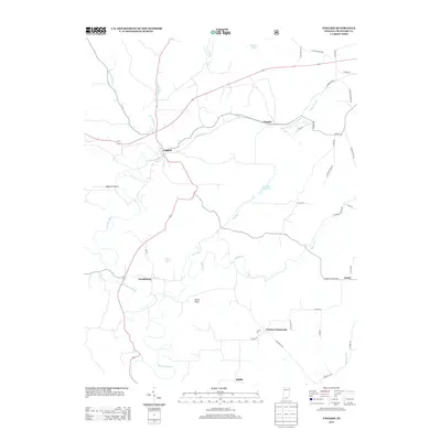
2013 Map of English
USGS Topo · Published 2013About this map
English stands as the primary hub in this southern Indiana landscape, situated where Bird Hollow Cr meets Camp Fork Cr. The terrain is defined by the winding course of the Little Blue River, which carves through the countryside past Grantsburg and toward Riddle. This 2013 survey illustrates a rural infrastructure of ridge roads and valley settlements, including Switzer Crossroads and Temple.
Find a feature on this map
45 named features on this map. Tap any name to fly to it.
Don’t see what you’re looking for? This feature index may not catch every label — zoom into the map to look around manually.
Map Details
Editions of this 2013 English Map
This is the sole edition of this map. No revisions or reprints were ever made.
Other maps of this area

1946 · Leavenworth
USGS Topo · 1:24,000

1947 · Leavenworth
USGS Topo · 1:24,000

1947 · Hardinsburg
USGS Topo · 1:24,000

1948 · Milltown
USGS Topo · 1:24,000

1949 · Hardinsburg
USGS Topo · 1:24,000

1950 · Beechwood
USGS Topo · 1:24,000

1950 · Valeene
USGS Topo · 1:24,000

1950 · English
USGS Topo · 1:24,000
1950 · Leavenworth
USGS Topo · 1:24,000

1950 · Alton
USGS Topo · 1:62,500