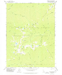
1977 Map of English Peak
USGS Topo · Published 1978About this map
Klamath National Forest and the Marble Mountain Wilderness define this high-elevation terrain in the mid-1970s. The landscape is a complex of glacial basins and sharp ridges, centered on English Peak and its surrounding alpine waters. The survey reveals a network of primitive transportation and seasonal habitation, marked by numerous named lakes such as Hancock Lake, Upper English Lake, and Wild Lake.
Find a feature on this map
64 named features on this map. Tap any name to fly to it.
Don’t see what you’re looking for? This feature index may not catch every label — zoom into the map to look around manually.
Map Details
Editions of this 1977 English Peak Map
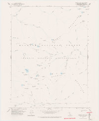
2 editions found
Other maps of this area

1914 · Seiad
USGS Topo · 1:125,000

1922 · Seiad
USGS Topo · 1:125,000

1948 · Weed
USGS Topo · 1:250,000

1950 · Weed
USGS Topo · 1:250,000

1955 · Sawyers Bar
USGS Topo · 1:62,500

1955 · Ukonom Lake
USGS Topo · 1:62,500

1955 · Scott Bar
USGS Topo · 1:62,500

1955 · Forks of Salmon
USGS Topo · 1:62,500

1958 · Weed
USGS Topo · 1:250,000

1963 · Weed
USGS Topo · 1:250,000