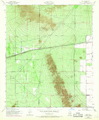
1952 Map of Enid
USGS Topo · Published 1968About this map
The Gila River Indian Reservation dominates the northern reaches of this Arizona landscape, where the Sierra Estrella range rises sharply from the valley floor. Settled life centers on the Southern Pacific railroad corridor, which links the small stations of Enid and Heaton. The presence of several Prospects and a Prospect throughout the southern mountains suggests early mineral exploration, while more contemporary 1950s infrastructure is evidenced by Gas Line Valves and a network of Oil Tank sites.
Find a feature on this map
19 named features on this map. Tap any name to fly to it.
Don’t see what you’re looking for? This feature index may not catch every label — zoom into the map to look around manually.
Map Details
Editions of this 1952 Enid Map
3 editions found
Other maps of this area

1913 · Maricopa
USGS Topo · 1:62,500

1915 · Maricopa
USGS Topo · 1:62,500

1946 · Antelope Peak
USGS Topo · 1:62,500

1948 · Antelope Peak
USGS Topo · 1:62,500

1951 · Estrella
USGS Topo · 1:62,500

1951 · Mobile
USGS Topo · 1:62,500

1952 · Maricopa
USGS Topo · 1:24,000
1952 · Pima Butte
USGS Topo · 1:24,000

1952 · Montezuma Peak
USGS Topo · 1:24,000

1952 · Enid
USGS Topo · 1:24,000