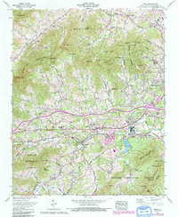
1961 Map of Enka
USGS Topo · Published 1991About this map
Enka serves as the industrial and residential heart of this region, defined by its relationship with Enka Lake and the nearby Southern Railway corridor. The landscape is a transition between the dense urban edge of Asheville and the protected slopes of the Pisgah National Forest to the southwest. Significant postwar development is evident in neighborhoods like New Candler, Woodside Hills, and Candler Heights, which established a suburban pattern along the Hominy Creek valley. Local genealogy is well-represented through numerous country churches and burial grounds, including the Francis Asbury Ch, Zion Hill Ch, and the Pisgah View Memorial Park. The presence of tailings ponds near the industrial center highlights the era's manufacturing footprint, while institutional landmarks like Mount Pisgah Academy and Clyde A Erwin High School anchor the community's social geography.
Find a feature on this map
95 named features on this map. Tap any name to fly to it.
Don’t see what you’re looking for? This feature index may not catch every label — zoom into the map to look around manually.
Map Details
Editions of this 1961 Enka Map
4 editions found
Other maps of this area

1894 · Asheville
USGS Topo · 1:125,000

1901 · Asheville
USGS Topo · 1:125,000

1905 · Pisgah
USGS Topo · 1:125,000

1906 · Pisgah
USGS Topo · 1:125,000

1935 · Cruso
USGS Topo · 1:24,000

1935 · Canton
USGS Topo · 1:24,000

1936 · Sandymush
USGS Topo · 1:24,000

1936 · Enka
USGS Topo · 1:24,000

1936 · Weaverville
USGS Topo · 1:24,000

1936 · Skyland
USGS Topo · 1:24,000