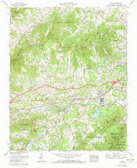
1961 Map of Enka
USGS Topo · Published 1972About this map
The industrial and educational landscape west of Asheville is captured in this 1961 survey, where the Southern Railway follows the path of Hominy Creek through the heart of the valley. This era marks a period of mid-century development for the Enka-Candler corridor, featuring the sprawling American Enka company footprint at Enka Village and the associated tailings ponds. Residential growth is evident in planned communities like Woodside Hills and Candler Heights, while the surrounding mountains maintain their agrarian and forested character. The northern reaches are defined by Newfound Mountain and its numerous gap crossings like Luther Gap, while the southwestern corner transitions into the protected territory of the Pisgah National Forest. The map serves as a detailed ledger of community institutions, from the Mount Pisgah Academy to numerous rural landmarks such as Dix Creek Chapel and Snow Hill Ch.
Find a feature on this map
112 named features on this map. Tap any name to fly to it.
Don’t see what you’re looking for? This feature index may not catch every label — zoom into the map to look around manually.
Map Details
Editions of this 1961 Enka Map
4 editions found
Other maps of this area

1894 · Asheville
USGS Topo · 1:125,000

1901 · Asheville
USGS Topo · 1:125,000

1905 · Pisgah
USGS Topo · 1:125,000

1906 · Pisgah
USGS Topo · 1:125,000

1935 · Cruso
USGS Topo · 1:24,000

1935 · Canton
USGS Topo · 1:24,000

1936 · Sandymush
USGS Topo · 1:24,000

1936 · Enka
USGS Topo · 1:24,000

1936 · Weaverville
USGS Topo · 1:24,000

1936 · Skyland
USGS Topo · 1:24,000