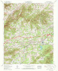
1961 Map of Enka
USGS Topo · Published 1972About this map
Enka Lake and the industrial-residential complex of Enka Village anchor the southeastern portion of this survey, reflecting the mid-century development of Buncombe County. This Tennessee Valley Authority mapping project details the transition from rural mountainous terrain to suburban clusters such as Woodside Hills and Candler Heights. The northern landscape is dominated by the ridges of Bert Mountain and Miller Mountain, separated by a network of gaps and coves like Dix Creek Gap and Deaver View Cove.
Find a feature on this map
96 named features on this map. Tap any name to fly to it.
Don’t see what you’re looking for? This feature index may not catch every label — zoom into the map to look around manually.
Map Details
Editions of this 1961 Enka Map
4 editions found
Other maps of this area

1894 · Asheville
USGS Topo · 1:125,000

1901 · Asheville
USGS Topo · 1:125,000

1905 · Pisgah
USGS Topo · 1:125,000

1906 · Pisgah
USGS Topo · 1:125,000

1935 · Cruso
USGS Topo · 1:24,000

1935 · Canton
USGS Topo · 1:24,000

1936 · Sandymush
USGS Topo · 1:24,000

1936 · Enka
USGS Topo · 1:24,000

1936 · Weaverville
USGS Topo · 1:24,000

1936 · Skyland
USGS Topo · 1:24,000