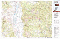
1989 Map of Ennis
USGS Topo · Published 1990About this map
The Madison River valley serves as the central corridor for this late-twentieth-century study, where ranching settlements and emerging recreational developments meet the high peaks of the Madison Range. Near the northern shore of Ennis Lake, the town of Ennis and the smaller community of McAllister anchor the valley's residential and commercial activity. Further east, the map documents the expansion of Big Sky Meadow Village and Big Sky Mountain Village, illustrating the area's transition into a major destination for mountain tourism during the 1980s.
Find a feature on this map
50 named features on this map. Tap any name to fly to it.
Don’t see what you’re looking for? This feature index may not catch every label — zoom into the map to look around manually.
Map Details
Editions of this 1989 Ennis Map
This is the sole edition of this map. No revisions or reprints were ever made.
Other maps of this area

1885 · Gallatin
USGS Topo · 1:125,000

1885 · Gallatin
USGS Topo · 1:125,000

1888 · Three Forks
USGS Topo · 1:250,000

1891 · Livingston
USGS Topo · 1:250,000

1893 · Dillon
USGS Topo · 1:250,000

1893 · Livingston
USGS Topo · 1:250,000

1894 · Three Forks
USGS Topo · 1:250,000

1895 · Three Forks
USGS Topo · 1:250,000

1901 · Gallatin
USGS Topo · 1:125,000

1908 · Gallatin
USGS Topo · 1:125,000