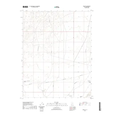
2020 Map of Enoch NE
USGS Topo · Published 2020About this map
Cedar Valley defines the lower-lying terrain of this Iron County landscape, where the transition from desert floor to upland drainages is marked by several named draws. Early 21st-century cattle-ranching and land-management routes like Horse Hollow Rd and Esplin Loop navigate the drainage basins of Mud Spring Canyon and Chalk Hollow. This 2020 record illustrates the enduring importance of water sources in the arid basin, anchored by the namesake Lost Spring in the northern hills. The map provides a detailed view of the local transportation network, including the reach of Gap Rd and the Jackrabbit Wash waterway, showing how contemporary access routes follow the natural contours of the valley floor and its surrounding hollows like Steer Hollow.
Find a feature on this map
15 named features on this map. Tap any name to fly to it.
Don’t see what you’re looking for? This feature index may not catch every label — zoom into the map to look around manually.
Map Details
Editions of this 2020 Enoch NE Map
This is the sole edition of this map. No revisions or reprints were ever made.
Other maps of this area

1885 · St. George
USGS Topo · 1:250,000

1885 · Beaver
USGS Topo · 1:250,000

1886 · Kanab
USGS Topo · 1:250,000

1891 · St. George
USGS Topo · 1:250,000

1950 · Enoch
USGS Topo · 1:24,000

1950 · Enoch
USGS Topo · 1:62,500

1950 · The Three Peaks
USGS Topo · 1:24,000

1950 · Enoch NE
USGS Topo · 1:24,000
1951 · The Three Peaks
USGS Topo · 1:24,000
1952 · Enoch NW
USGS Topo · 1:24,000