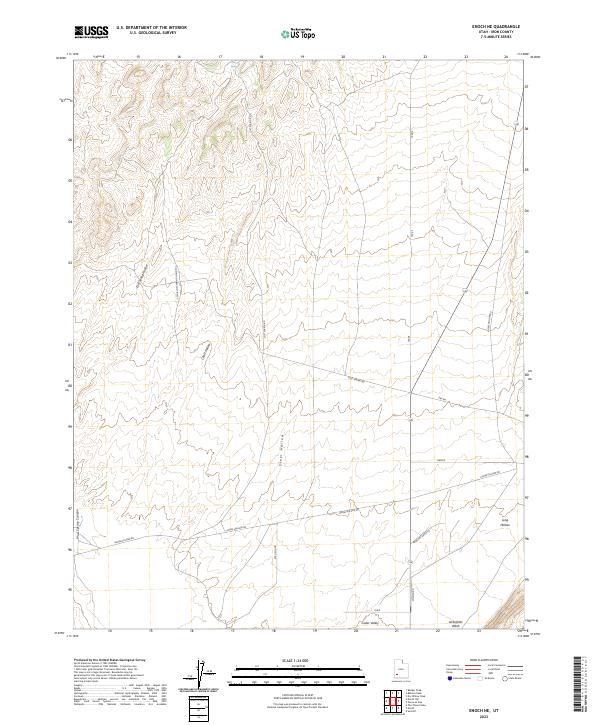
2023 Map of Enoch NE
USGS Topo · Published 2023About this map
Cedar Valley defines the southwestern portion of this Iron County landscape, where the flat valley floor meets a series of deeply incised drainages and upland ridges. The mapping reveals a sparse network of ranch and access roads, including Horse Hollow Rd and Gap Rd, which navigate the varying elevations between Steer Hollow and Mud Spring Canyon.
Find a feature on this map
18 named features on this map. Tap any name to fly to it.
Don’t see what you’re looking for? This feature index may not catch every label — zoom into the map to look around manually.
Map Details
Editions of this 2023 Enoch NE Map
This is the sole edition of this map. No revisions or reprints were ever made.
Other maps of this area

1885 · St. George
USGS Topo · 1:250,000

1885 · Beaver
USGS Topo · 1:250,000

1886 · Kanab
USGS Topo · 1:250,000

1891 · St. George
USGS Topo · 1:250,000

1950 · Enoch
USGS Topo · 1:24,000

1950 · Enoch
USGS Topo · 1:62,500

1950 · The Three Peaks
USGS Topo · 1:24,000

1950 · Enoch NE
USGS Topo · 1:24,000
1951 · The Three Peaks
USGS Topo · 1:24,000
1952 · Enoch NW
USGS Topo · 1:24,000