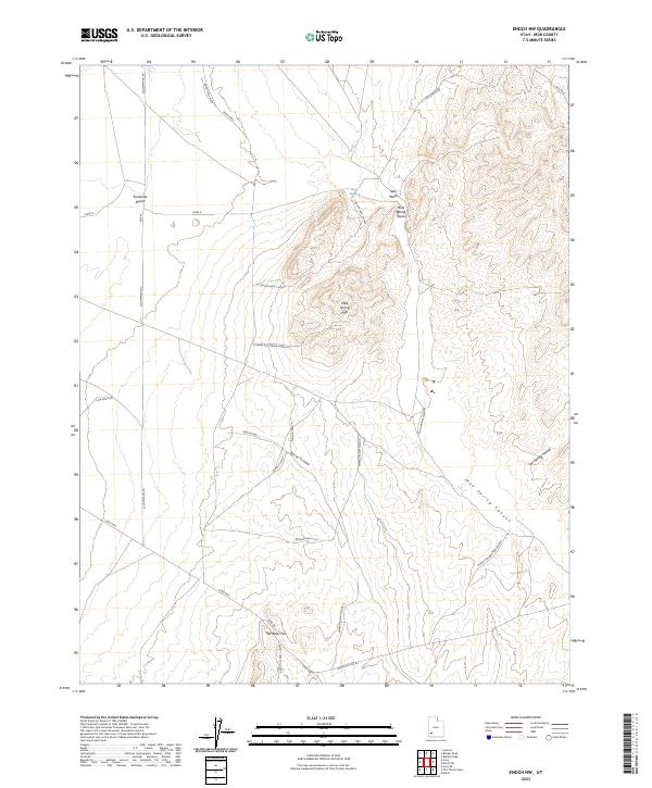
2023 Map of Enoch NW
USGS Topo · Published 2023About this map
Escalante Desert terrain and arid livestock ranching infrastructure dominate this portion of Iron County. The landscape is defined by the Mud Spring Hills and the northern reaches of The Bald Hills, where water access was historically managed through a network of isolated sites like Mud Spring, Norte Well, and Nelson Well 2. This 2023 survey illustrates how modern desert transit follows ancient natural corridors, with the Lund Hwy cutting across the southwestern flats. In the eastern uplands, rugged relief is found around Jako Peak, which overlooks a system of drainages including Mud Spring Canyon and Lost Spring Hollow. A complex grid of specialized desert roads, such as the T Nelson Well Cutoff and Bald Hills East Cutoff, suggests a landscape organized around grazing rights and well maintenance in a challenging environment.
Find a feature on this map
30 named features on this map. Tap any name to fly to it.
Don’t see what you’re looking for? This feature index may not catch every label — zoom into the map to look around manually.
Map Details
Editions of this 2023 Enoch NW Map
This is the sole edition of this map. No revisions or reprints were ever made.
Other maps of this area

1885 · St. George
USGS Topo · 1:250,000

1891 · St. George
USGS Topo · 1:250,000

1950 · Enoch
USGS Topo · 1:24,000

1950 · Enoch
USGS Topo · 1:62,500

1950 · The Three Peaks
USGS Topo · 1:24,000

1950 · Enoch NE
USGS Topo · 1:24,000

1950 · Avon SE
USGS Topo · 1:24,000

1951 · Avon SE
USGS Topo · 1:24,000
1951 · The Three Peaks
USGS Topo · 1:24,000

1951 · Avon
USGS Topo · 1:24,000