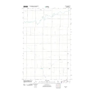
2010 Map of Enok
USGS Topo · Published 2010About this map
Enok serves as the quiet focal point of this rural Kittson County landscape, which is defined by the winding course of the South Branch Two Rivers. The map reveals a community deeply rooted in its local history, with several burial sites scattered across the township grid. From the Two Rivers Cemetery in the north to the Jupiter Mission Cemetery and Jupiter Cemetery further south, these locations provide essential data points for genealogical research.
Find a feature on this map
31 named features on this map. Tap any name to fly to it.
Don’t see what you’re looking for? This feature index may not catch every label — zoom into the map to look around manually.
Map Details
Editions of this 2010 Enok Map
This is the sole edition of this map. No revisions or reprints were ever made.
Other maps of this area

1918 · Hemmington
USGS Topo · 1:62,500

1939 · Kennedy
USGS Topo · 1:62,500

1941 · Kennedy
USGS Topo · 1:62,500

1941 · Hallock
USGS Topo · 1:62,500

1952 · Thief River Falls
USGS Topo · 1:250,000

1956 · Thief River Falls
USGS Topo · 1:250,000

1956 · Karlstad
USGS Topo · 1:62,500

1957 · Thief River Falls
USGS Topo · 1:250,000
1966 · Skull Lake SW
USGS Topo · 1:24,000

1967 · Thief River Falls
USGS Topo · 1:250,000