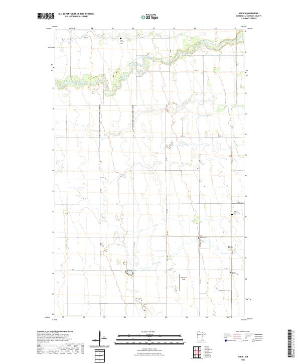
2022 Map of Enok
USGS Topo · Published 2022About this map
Enok and the surrounding prairie of Kittson County are defined by a quiet, agrarian landscape where the South Branch Two Rivers meanders through the northern townships. The settlement pattern is rooted in a traditional grid of section lines and county roads, such as Co RD 22 and Co RD 7, which connect isolated farmsteads and rural landmarks. The importance of early community ties is evident in the cluster of burial sites found here, including the Two Rivers Cem, Jupiter Community Cem, and the West Emmaus Cem.
Find a feature on this map
25 named features on this map. Tap any name to fly to it.
Don’t see what you’re looking for? This feature index may not catch every label — zoom into the map to look around manually.
Map Details
Editions of this 2022 Enok Map
This is the sole edition of this map. No revisions or reprints were ever made.
Other maps of this area

1918 · Hemmington
USGS Topo · 1:62,500

1939 · Kennedy
USGS Topo · 1:62,500

1941 · Kennedy
USGS Topo · 1:62,500

1941 · Hallock
USGS Topo · 1:62,500

1952 · Thief River Falls
USGS Topo · 1:250,000

1956 · Thief River Falls
USGS Topo · 1:250,000

1956 · Karlstad
USGS Topo · 1:62,500

1957 · Thief River Falls
USGS Topo · 1:250,000
1966 · Skull Lake SW
USGS Topo · 1:24,000

1967 · Thief River Falls
USGS Topo · 1:250,000