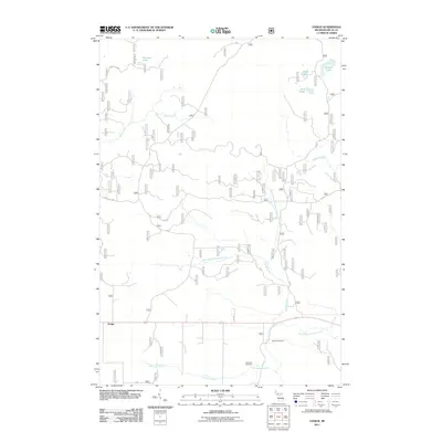
2011 Map of Ensign
USGS Topo · Published 2011About this map
The settlement of Ensign is the central point for this Delta County survey, situated amidst a landscape defined by an extensive hydrological network. The Ogontz River system dominates the drainage here, with the North Branch Ogontz River, West Branch Ogontz River, and East Branch Ogontz River all converging south of the township's primary roads. Local history is anchored by the Johnston Cemetery and Ogontz Cemetery, both located near Johnston Creek in the southern portion of the quadrangle. This area of Michigan's Upper Peninsula is characterized by numerous water bodies, including Peterson Lake, Ramsey Lake, and Lost Lakes, which sit among a grid of forest service roads like Forest Rd 2803 and Forest Rd 2231. The mapping of these minor tributaries and rural burial grounds provides valuable detail for those researching the land use and genealogy of the Ensign area.
Find a feature on this map
20 named features on this map. Tap any name to fly to it.
Don’t see what you’re looking for? This feature index may not catch every label — zoom into the map to look around manually.
Map Details
Editions of this 2011 Ensign Map
This is the sole edition of this map. No revisions or reprints were ever made.
Other maps of this area

1932 · Rapid River NE
USGS Topo · 1:31,680

1932 · Trenary SW
USGS Topo · 1:31,680

1932 · Garden NW and SW
USGS Topo · 1:31,680

1932 · Rapid River NW
USGS Topo · 1:31,680

1932 · Trenary SE
USGS Topo · 1:31,680

1932 · Rapid River SE
USGS Topo · 1:31,680

1932 · Skeels Lake NW and SW
USGS Topo · 1:31,680

1932 · Rapid River SW
USGS Topo · 1:31,680

1954 · Escanaba
USGS Topo · 1:250,000

1957 · Escanaba
USGS Topo · 1:250,000