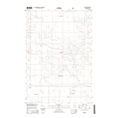
2014 Map of Ensign
USGS Topo · Published 2014About this map
Hiawatha National Forest dominates the landscape of this Delta County quadrangle, where the upper reaches of the Ogontz River system drain toward the south. The small settlement of Ensign sits in the southwestern corner, serving as a primary point of human activity within a territory defined by intricate creek networks and low-lying wetlands. The hydrology here is complex, featuring the W Br Ogontz River, E Br Ogontz River, and the N Br Ogontz River, alongside several secluded water bodies such as Peterson Lake and Ramsey Lake.
Find a feature on this map
19 named features on this map. Tap any name to fly to it.
Don’t see what you’re looking for? This feature index may not catch every label — zoom into the map to look around manually.
Map Details
Editions of this 2014 Ensign Map
This is the sole edition of this map. No revisions or reprints were ever made.
Other maps of this area

1932 · Rapid River NE
USGS Topo · 1:31,680

1932 · Trenary SW
USGS Topo · 1:31,680

1932 · Garden NW and SW
USGS Topo · 1:31,680

1932 · Rapid River NW
USGS Topo · 1:31,680

1932 · Trenary SE
USGS Topo · 1:31,680

1932 · Rapid River SE
USGS Topo · 1:31,680

1932 · Skeels Lake NW and SW
USGS Topo · 1:31,680

1932 · Rapid River SW
USGS Topo · 1:31,680

1954 · Escanaba
USGS Topo · 1:250,000

1957 · Escanaba
USGS Topo · 1:250,000