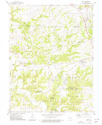
1975 Map of Eolia
USGS Topo · Published 1977About this map
Eolia and the surrounding borderlands of Pike and Lincoln Counties are defined by a complex network of waterways, including the Cuivre River and its numerous tributaries such as Sandy Creek, Little Sandy Creek, and Sulphur Creek. This mid-1970s landscape shows a mix of agricultural land and state-managed conservation areas, most notably the William Logan State Wildlife Area and Vonaventure State Memorial Forest and Wildlife Area. The map reveals the imprint of early transportation through labels like Old Railroad Grade and Railroad Grade, indicating the path of former rail lines that once served this rural region.
Find a feature on this map
50 named features on this map. Tap any name to fly to it.
Don’t see what you’re looking for? This feature index may not catch every label — zoom into the map to look around manually.
Map Details
Editions of this 1975 Eolia Map
2 editions found
Other maps of this area

1890 · Louisiana
USGS Topo · 1:125,000

1930 · Nebo
USGS Topo · 1:62,500

1934 · Nebo
USGS Topo · 1:48,000

1934 · Elsberry
USGS Topo · 1:48,000

1937 · Silex
USGS Topo · 1:62,500

1937 · Bowling Green
USGS Topo · 1:62,500

1939 · Silex
USGS Topo · 1:48,000

1940 · Bowling Green
USGS Topo · 1:62,500

1942 · Nebo
USGS Topo · 1:62,500

1942 · Elsberry
USGS Topo · 1:62,500