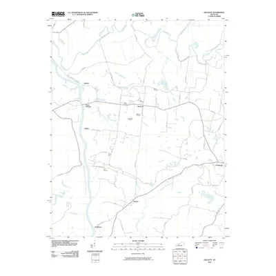
2010 Map of Equality
USGS Topo · Published 2010About this map
The Green River and Rough River define the hydraulic character of this western Kentucky landscape, where small rural settlements are scattered across the fertile bottomlands and low ridges. Local genealogy is particularly well-represented here, with numerous family burial grounds including the Patterson Cemetery, Bell Cemetery, and Tichnor Cemetery situated near the crossroads of Matanzas. The map reveals a highly localized road network such as Knots Ferry Loop and Carter Ferry RD, indicating a history of river-dependent transit and connectivity before modern bridges predominated.
Find a feature on this map
49 named features on this map. Tap any name to fly to it.
Don’t see what you’re looking for? This feature index may not catch every label — zoom into the map to look around manually.
Map Details
Editions of this 2010 Equality Map
This is the sole edition of this map. No revisions or reprints were ever made.
Other maps of this area

1906 · Sutherland
USGS Topo · 1:62,500

1907 · Whitesville
USGS Topo · 1:62,500

1909 · Whitesville
USGS Topo · 1:62,500

1909 · Hartford
USGS Topo · 1:62,500

1909 · Central City
USGS Topo · 1:62,500

1952 · Equality
USGS Topo · 1:24,000

1952 · Livermore
USGS Topo · 1:24,000

1953 · Central City West
USGS Topo · 1:24,000

1953 · Central City East
USGS Topo · 1:24,000

1953 · Utica
USGS Topo · 1:24,000