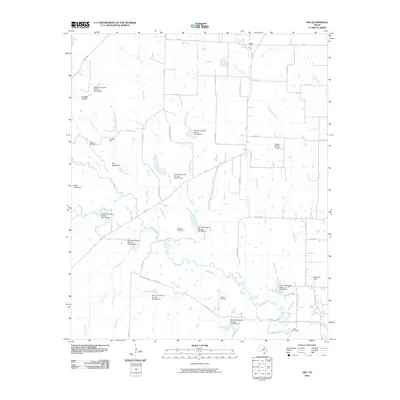
2010 Map of Era
USGS Topo · Published 2010About this map
Era and its surrounding ranchlands are defined by a complex network of water management and petroleum extraction in this northern Texas landscape. The territory is marked by numerous flood control structures, such as Soil Conservation Service Site 47 Dam and Soil Conservation Service Site 50 Dam, which regulate the tributaries of Clear Creek. These dams reflect decades of concerted effort by the Soil Conservation Service to manage erosion and runoff in a region dominated by cattle ranching and agriculture.
Find a feature on this map
55 named features on this map. Tap any name to fly to it.
Don’t see what you’re looking for? This feature index may not catch every label — zoom into the map to look around manually.
Map Details
Editions of this 2010 Era Map
This is the sole edition of this map. No revisions or reprints were ever made.
Other maps of this area

1902 · Gainesville
USGS Topo · 1:125,000

1943 · Gainesville
USGS Topo · 1:125,000

1954 · Sherman
USGS Topo · 1:250,000

1958 · Sherman
USGS Topo · 1:250,000

1960 · Sanger
USGS Topo · 1:24,000

1960 · Gainesville South
USGS Topo · 1:24,000

1961 · Freemound
USGS Topo · 1:24,000

1961 · Era
USGS Topo · 1:24,000

1961 · Slidell
USGS Topo · 1:24,000
1961 · Era SE
USGS Topo · 1:24,000