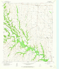
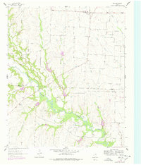
1961 Map of Era
USGS Topo · Published 1963About this map
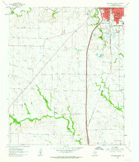
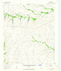
The community of Era sits at the northern edge of this North Texas landscape, where the rolling plains begin to drop toward the significant watercourse of Clear Creek. This 1961 field check reveals a rural economy deeply tied to the land, transitioning from the open grazing and farming of the upland flats into the industrial activity of the Bolivar Oil Field and the Bundy oil field. The most striking topographical feature is The Backbone, a prominent ridge overlooking the winding channel of Clear Creek, which acts as a natural corridor through the terrain. For those researching local lineages, the map identifies several family-named burial grounds including Cogburn Cem, Moss Cem, Gregory Cem, and King Cem. The confluence of numerous drainages such as Buck Creek and Grasshopper Creek illustrates the complex hydraulic network of the Cooke and Denton County border region before modern development altered these rural drainage patterns.
Find a feature on this map
24 named features on this map. Tap any name to fly to it.
Don’t see what you’re looking for? This feature index may not catch every label — zoom into the map to look around manually.
Map Details
Editions of this 1961 Era Map
2 editions found
Other maps of this area

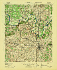
1902 · Gainesville
USGS Topo · 1:125,000
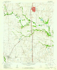
1943 · Gainesville
USGS Topo · 1:125,000

1954 · Sherman
USGS Topo · 1:250,000

1958 · Sherman
USGS Topo · 1:250,000
1960 · Sanger
USGS Topo · 1:24,000
1960 · Gainesville South
USGS Topo · 1:24,000
1961 · Freemound
USGS Topo · 1:24,000
1961 · Slidell
USGS Topo · 1:24,000
1961 · Era SE
USGS Topo · 1:24,000
1961 · Hood
USGS Topo · 1:24,000