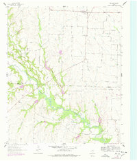
1961 Map of Era
USGS Topo · Published 1978About this map
The community of Era sits at the northern edge of this North Texas survey, serving as a focal point for the surrounding agricultural landscape along the Cooke Co Denton Co border. The terrain is defined by the winding course of Clear Creek, which carves through the central portion of the map, flanked by significant geographic features like The Backbone and several drainage systems including Flat Creek and Duck Creek.
Find a feature on this map
25 named features on this map. Tap any name to fly to it.
Don’t see what you’re looking for? This feature index may not catch every label — zoom into the map to look around manually.
Map Details
Editions of this 1961 Era Map
2 editions found
Other maps of this area

1902 · Gainesville
USGS Topo · 1:125,000

1943 · Gainesville
USGS Topo · 1:125,000

1954 · Sherman
USGS Topo · 1:250,000

1958 · Sherman
USGS Topo · 1:250,000

1960 · Sanger
USGS Topo · 1:24,000

1960 · Gainesville South
USGS Topo · 1:24,000

1961 · Freemound
USGS Topo · 1:24,000

1961 · Era
USGS Topo · 1:24,000

1961 · Slidell
USGS Topo · 1:24,000
1961 · Era SE
USGS Topo · 1:24,000