
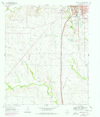
1960 Map of Gainesville South
USGS Topo · Published 1963About this map
Gainesville serves as a regional hub for the northern Texas landscape in the early 1960s, defined by its intersection of water and rail. The town’s southern edge is bounded by the winding Elm Fork Trinity River, while its industrial character is shaped by the Missouri-Kansas-Texas and Gulf Colorado and Santa Fe railroads. Evidence of mid-century growth and community infrastructure is visible through landmarks such as the Refinery, Gainesville Jr College, and Leeper Stadium.
Find a feature on this map
36 named features on this map. Tap any name to fly to it.
Don’t see what you’re looking for? This feature index may not catch every label — zoom into the map to look around manually.
Map Details
Editions of this 1960 Gainesville South Map
2 editions found
Other maps of this area

1902 · Gainesville
USGS Topo · 1:125,000

1943 · Gainesville
USGS Topo · 1:125,000

1954 · Sherman
USGS Topo · 1:250,000

1958 · Sherman
USGS Topo · 1:250,000

1960 · Callisburg
USGS Topo · 1:24,000

1960 · Gainesville North
USGS Topo · 1:24,000

1960 · Woodbine
USGS Topo · 1:24,000

1961 · Era
USGS Topo · 1:24,000

1961 · Hood
USGS Topo · 1:24,000

1961 · Muenster East
USGS Topo · 1:24,000