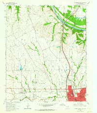
1960 Map of Gainesville North
USGS Topo · Published 1964About this map
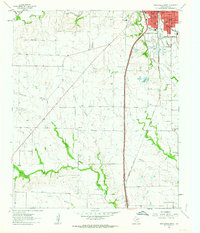
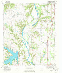
Gainesville sits at the southern edge of this 1960 survey, serving as a hub where the Gulf Colorado and Santa Fe and Missouri Kansas Texas railroads intersect. The town's layout is well-defined, featuring several educational institutions like the Robert E Lee Sch, Franklin Sch, and Washington Sch. Just west of the city limits, Lindsay appears as a smaller cluster of activity, anchored by the St Peter Sch. The landscape to the north is dominated by the ridges and creeks leading toward the Red River, which forms the border between Oklahoma and Texas.
Find a feature on this map
37 named features on this map. Tap any name to fly to it.
Don’t see what you’re looking for? This feature index may not catch every label — zoom into the map to look around manually.
Map Details
Editions of this 1960 Gainesville North Map
2 editions found
Other maps of this area

1902 · Gainesville
USGS Topo · 1:125,000
1943 · Gainesville
USGS Topo · 1:125,000

1954 · Sherman
USGS Topo · 1:250,000

1958 · Sherman
USGS Topo · 1:250,000
1960 · Callisburg
USGS Topo · 1:24,000
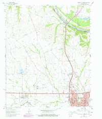
1960 · Gainesville South
USGS Topo · 1:24,000
1960 · Woodbine
USGS Topo · 1:24,000
1961 · Hood
USGS Topo · 1:24,000
1961 · Muenster East
USGS Topo · 1:24,000
1968 · Thackerville
USGS Topo · 1:24,000