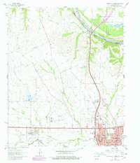
1960 Map of Gainesville North
USGS Topo · Published 1978About this map
Gainesville serves as the focal point of this North Texas study, situated at the confluence of several key transport and geographic boundaries. The northern border follows the winding Red River along the Oklahoma Texas state line, where the river broadens into the southern reaches of Lake Texoma. This 1960s landscape shows a community built on a mixture of aviation, agriculture, and industry, with the Gainesville Municipal Airport and multiple Gravel Pits punctuating the terrain.
Find a feature on this map
35 named features on this map. Tap any name to fly to it.
Don’t see what you’re looking for? This feature index may not catch every label — zoom into the map to look around manually.
Map Details
Editions of this 1960 Gainesville North Map
2 editions found
Other maps of this area

1902 · Gainesville
USGS Topo · 1:125,000

1943 · Gainesville
USGS Topo · 1:125,000

1954 · Sherman
USGS Topo · 1:250,000

1958 · Sherman
USGS Topo · 1:250,000

1960 · Callisburg
USGS Topo · 1:24,000

1960 · Gainesville South
USGS Topo · 1:24,000

1960 · Gainesville North
USGS Topo · 1:24,000

1960 · Woodbine
USGS Topo · 1:24,000

1961 · Hood
USGS Topo · 1:24,000

1961 · Muenster East
USGS Topo · 1:24,000