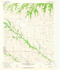
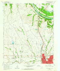
1961 Map of Muenster East
USGS Topo · Published 1963About this map
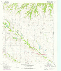
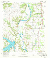
The town of Muenster and the smaller community of Myra anchor this landscape during a period of steady growth along the Missouri-Kansas-Texas railroad corridor. The terrain is defined by the prominent Wolf Ridge, which separates numerous drainage systems including Opossum Hollow and Black Hollow to the north from the intricate creek networks to the south. The presence of both the Hayes Cem and Van Slyke Cem provides specific points of interest for genealogists tracing early families in this portion of Cooke County.
Find a feature on this map
18 named features on this map. Tap any name to fly to it.
Don’t see what you’re looking for? This feature index may not catch every label — zoom into the map to look around manually.
Map Details
Editions of this 1961 Muenster East Map
2 editions found
Other maps of this area

1902 · Gainesville
USGS Topo · 1:125,000
1943 · Gainesville
USGS Topo · 1:125,000

1954 · Sherman
USGS Topo · 1:250,000

1958 · Sherman
USGS Topo · 1:250,000
1960 · Gainesville South
USGS Topo · 1:24,000
1960 · Gainesville North
USGS Topo · 1:24,000
1961 · Muenster West
USGS Topo · 1:24,000
1961 · Freemound
USGS Topo · 1:24,000
1961 · Hood
USGS Topo · 1:24,000
1968 · Thackerville
USGS Topo · 1:24,000