
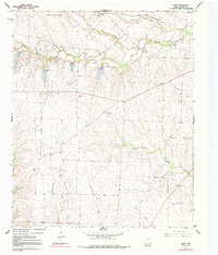
1961 Map of Hood
USGS Topo · Published 1963About this map
The Elm Fork Trinity River winds across this north-central Texas landscape, carving a valley defined by several small spillways and a network of seasonal tributaries like Tonkawa Creek and Spring Creek. In the early 1960s, this portion of Cooke County was defined by its dual economy of cattle ranching and petroleum extraction. The surface is crisscrossed by fence lines, while the subsurface is tapped by the Gruber Oil Field, Brewer Oil Field, and the Era Ellenburger Oil Field, showing the extensive reach of the local energy industry during this era. Small rural settlements serve as local anchors, including Myra along the Missouri Kansas Texas rail line, and the namesake hamlet of Hood. Genealogists will find critical landmarks such as Hood Cem, Reed Cem, and Era Cem, which offer physical links to the early families of this agricultural and oil-producing region.
Find a feature on this map
24 named features on this map. Tap any name to fly to it.
Don’t see what you’re looking for? This feature index may not catch every label — zoom into the map to look around manually.
Map Details
Editions of this 1961 Hood Map
2 editions found
Other maps of this area

1902 · Gainesville
USGS Topo · 1:125,000

1943 · Gainesville
USGS Topo · 1:125,000

1954 · Sherman
USGS Topo · 1:250,000

1958 · Sherman
USGS Topo · 1:250,000

1960 · Gainesville South
USGS Topo · 1:24,000

1960 · Gainesville North
USGS Topo · 1:24,000

1961 · Muenster West
USGS Topo · 1:24,000

1961 · Freemound
USGS Topo · 1:24,000

1961 · Era
USGS Topo · 1:24,000

1961 · Muenster East
USGS Topo · 1:24,000