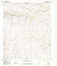
1961 Map of Hood
USGS Topo · Published 1991About this map
The Elm Fork Trinity River winds through the northern portion of this landscape, carving a valley where the Gatewood Oil Field and Brewer Oil Field indicate the era's active petroleum extraction. This 1961 field-checked survey reveals a rural Cooke County environment defined by small settlements like Hood and Myra, and the prominent traces of an Old Railroad Grade running near Tonkawa. The distribution of family and community spaces is marked by the Hood Cem, Reed Cem, and Era Cem, which offer significant touchpoints for genealogical research. The terrain is deeply etched by a network of drainage systems including Grasshopper Creek, Duck Creek, and Spring Creek, which feed into the larger river basin. To the south, the Ellenburger Field and Gruber Oil Field highlight the extent of the local oil economy, while the transition from river bottoms to the Era Flat Creek upland illustrates the traditional land use patterns of north Texas.
Find a feature on this map
22 named features on this map. Tap any name to fly to it.
Don’t see what you’re looking for? This feature index may not catch every label — zoom into the map to look around manually.
Map Details
Editions of this 1961 Hood Map
2 editions found
Other maps of this area

1902 · Gainesville
USGS Topo · 1:125,000

1943 · Gainesville
USGS Topo · 1:125,000

1954 · Sherman
USGS Topo · 1:250,000

1958 · Sherman
USGS Topo · 1:250,000

1960 · Gainesville South
USGS Topo · 1:24,000

1960 · Gainesville North
USGS Topo · 1:24,000

1961 · Muenster West
USGS Topo · 1:24,000

1961 · Freemound
USGS Topo · 1:24,000

1961 · Era
USGS Topo · 1:24,000

1961 · Hood
USGS Topo · 1:24,000