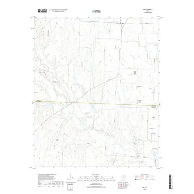
2019 Map of Era
USGS Topo · Published 2019About this map
The small settlement of Era serves as the focal point of this North Texas landscape, situated along the boundary where the northern edge of Denton County meets southern Cooke County. The terrain is defined by a series of branching waterways, including Clear Creek, Flat Creek, and Buck Cr, which carve through the countryside to create prominent landforms like The Backbone. This 2019 survey documents a rural environment characterized by a network of private airstrips, such as the Flying D Ranch Airport and Edgington Ranch Airport, alongside several historic burial grounds including Cogburn Cem, Moss Cem, and Knox Cem. The map illustrates a contemporary rural economy where modern aviation and ranching interests coexist with long-established family homesteads and traditional county roads.
Find a feature on this map
61 named features on this map. Tap any name to fly to it.
Don’t see what you’re looking for? This feature index may not catch every label — zoom into the map to look around manually.
Map Details
Editions of this 2019 Era Map
This is the sole edition of this map. No revisions or reprints were ever made.
Other maps of this area

1902 · Gainesville
USGS Topo · 1:125,000

1943 · Gainesville
USGS Topo · 1:125,000

1954 · Sherman
USGS Topo · 1:250,000

1958 · Sherman
USGS Topo · 1:250,000

1960 · Sanger
USGS Topo · 1:24,000

1960 · Gainesville South
USGS Topo · 1:24,000

1961 · Freemound
USGS Topo · 1:24,000

1961 · Era
USGS Topo · 1:24,000

1961 · Slidell
USGS Topo · 1:24,000
1961 · Era SE
USGS Topo · 1:24,000