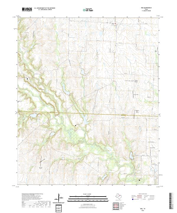
2022 Map of Era
USGS Topo · Published 2022About this map
The settlement of Era sits at the northern edge of this North Texas survey, where the rolling prairies of the Red River Valley transition into the rugged breaks of the Cross Timbers. The landscape is defined by the winding course of Clear Creek and its many tributaries, including Flat Creek, Buck Cr, and Grasshopper Cr, which carve through the terrain near the prominent ridge known as The Backbone. This rural landscape reflects a modern ranching and aviation-oriented economy, evidenced by several private airstrips such as Akroville Airport, Edgington Ranch Airport, and Flying D Ranch Airport. Genealogists will find significant value in the preservation of local history through several family and community burial grounds, including Cogburn Cem, Moss Cem, Gregory Cem, and Knox Cem, which remain scattered across the countryside along old farm-to-market roads like FM 51 and FM 922.
Find a feature on this map
61 named features on this map. Tap any name to fly to it.
Don’t see what you’re looking for? This feature index may not catch every label — zoom into the map to look around manually.
Map Details
Editions of this 2022 Era Map
This is the sole edition of this map. No revisions or reprints were ever made.
Other maps of this area

1902 · Gainesville
USGS Topo · 1:125,000

1943 · Gainesville
USGS Topo · 1:125,000

1954 · Sherman
USGS Topo · 1:250,000

1958 · Sherman
USGS Topo · 1:250,000

1960 · Sanger
USGS Topo · 1:24,000

1960 · Gainesville South
USGS Topo · 1:24,000

1961 · Freemound
USGS Topo · 1:24,000

1961 · Era
USGS Topo · 1:24,000

1961 · Slidell
USGS Topo · 1:24,000
1961 · Era SE
USGS Topo · 1:24,000