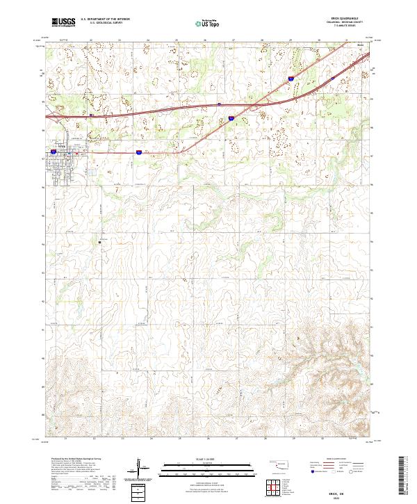
2022 Map of Erick
USGS Topo · Published 2022About this map
Erick sits at the intersection of local history and the modern landscape, where the street grid honors its past through names like Sheb Woolley Ave and W Walnut Ave. This western Oklahoma landscape is defined by its section-line road network and a series of intermittent waterways, including Turkey Cr and Haystack Cr, which carve through the plains. To the north, the small community of Hext marks a point along the transportation corridor that parallels the Interstate. Genealogists and local historians can locate the Erick Cem south of the town center, a primary landmark in a region otherwise dominated by agricultural sections. The map detail highlights the transition from the organized town blocks of Erick to the wide-open drainage basins of Deer Cr and Fish Cr in the southern reaches of the quadrangle.
Find a feature on this map
55 named features on this map. Tap any name to fly to it.
Don’t see what you’re looking for? This feature index may not catch every label — zoom into the map to look around manually.
Map Details
Editions of this 2022 Erick Map
This is the sole edition of this map. No revisions or reprints were ever made.
Other maps of this area

1955 · Clinton
USGS Topo · 1:250,000

1957 · Clinton
USGS Topo · 1:250,000

1960 · Sweetwater
USGS Topo · 1:62,500

1960 · Sayre
USGS Topo · 1:62,500

1961 · Willow
USGS Topo · 1:62,500

1961 · Erick
USGS Topo · 1:62,500

1985 · Elk City
USGS Topo · 1:100,000
1989 · Erick
USGS Topo · 1:24,000
1989 · Delhi
USGS Topo · 1:24,000
1989 · Prentiss
USGS Topo · 1:24,000