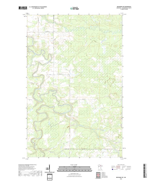
2022 Map of Ericsburg SW
USGS Topo · Published 2022About this map
The Little Fork River carves a winding, serpentine path through this pocket of the Northwoods, its meandering oxbows defining the landscape's hydrological character. Modern access is facilitated by a network of county and local roads, including Co Hwy 8 and Douglas Rd, which cut through the dense wetlands and forest typical of Koochiching County. The area is intersected by smaller watercourses such as Beaver Brook and Ester-Brook, which drain into the larger river system.
Find a feature on this map
24 named features on this map. Tap any name to fly to it.
Don’t see what you’re looking for? This feature index may not catch every label — zoom into the map to look around manually.
Map Details
Editions of this 2022 Ericsburg SW Map
This is the sole edition of this map. No revisions or reprints were ever made.
Other maps of this area

1919 · Happy Land
USGS Topo · 1:62,500

1919 · M
USGS Topo · 1:62,500

1954 · International Falls
USGS Topo · 1:250,000

1957 · International Falls
USGS Topo · 1:250,000

1958 · International Falls
USGS Topo · 1:250,000

1969 · Ericsburg NW
USGS Topo · 1:24,000

1969 · Ericsburg
USGS Topo · 1:24,000

1969 · Ericsburg SE
USGS Topo · 1:24,000

1969 · Ericsburg SW
USGS Topo · 1:24,000

1970 · Littlefork SE
USGS Topo · 1:24,000