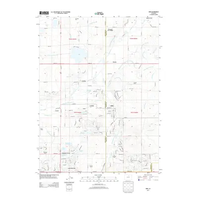
2013 Map of Erie
USGS Topo · Published 2013About this map
The town of Erie sits at the heart of this landscape, straddling the boundary between Boulder and Weld counties during a period of significant suburban growth. The area's agricultural history is written in its complex network of water infrastructure, including the Boulder and Weld County Ditch and the Lower Boulder Ditch, which traverse the plains to support local farming and reservoirs like Panama Reservoir. To the south, the city of Lafayette anchors the map, with residential developments expanding toward landmarks such as Prince Lake Number 2 and Erie Lake. The presence of several small airfields, including Erie Municipal Airport, Parkland Airport, and Fox Hole Airport, highlights the region's diverse transportation and recreational infrastructure. Smaller settlements like Canfield, Tabor, and Leyner provide specific points of interest for those tracing the evolution of these Front Range communities.
Find a feature on this map
142 named features on this map. Tap any name to fly to it.
Don’t see what you’re looking for? This feature index may not catch every label — zoom into the map to look around manually.
Map Details
Editions of this 2013 Erie Map
This is the sole edition of this map. No revisions or reprints were ever made.
Other maps of this area

1890 · East Denver
USGS Topo · 1:125,000

1899 · West Denver
USGS Topo · 1:125,000

1902 · Greeley
USGS Topo · 1:125,000

1904 · Niwot
USGS Topo · 1:62,500

1940 · Eastlake
USGS Topo · 1:31,680

1940 · Lafayette
USGS Topo · 1:31,680

1942 · Louisville
USGS Topo · 1:31,680

1944 · Lafayette
USGS Topo · 1:31,680

1944 · Eastlake
USGS Topo · 1:31,680

1949 · Gowanda
USGS Topo · 1:24,000