1950 Map of Erie
USGS Topo · Published 1953About this map
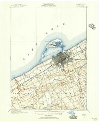
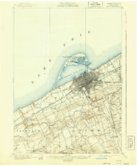
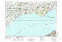
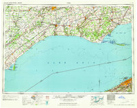
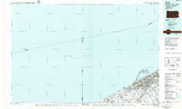
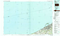
Lake Erie defines this mid-century international landscape, where the waters of Long Point Bay and Inner Bay separate the agricultural plains of Ontario from the industrial shoreline of Pennsylvania. The map highlights a dense network of major railroads that powered the regional economy, including the Michigan Central and Canadian National lines north of the lake, and the Pennsylvania railroad serving the south. On the Canadian side, numerous small crossroads and rail-stop settlements like Iona Station, Shedden, and West Lorne dot the landscape between the Thames River and the lake shore. Coastal navigation is anchored by prominent landmarks such as the Long Point Light and Port Burwell Light, while the distinct geography of Long Point and Presque Isle serves as a reminder of the shifting sands and strategic importance of these natural harbors for maritime commerce and travel during the post-war era.
Find a feature on this map
226 named features on this map. Tap any name to fly to it.
Don’t see what you’re looking for? This feature index may not catch every label — zoom into the map to look around manually.
Map Details
Editions of this 1950 Erie Map
This is the sole edition of this map. No revisions or reprints were ever made.
Historical Maps of Erie Through Time
7 maps found